
SAM provided easement surveying services for an Indefinite Delivery Indefinite Quantity (IDIQ) A&E services contract to the USDA Natural Resources Conservation Service for the Wetlands Reserve and Grasslands Reserve Programs, and have surveyed over 12,000 acres across Texas.
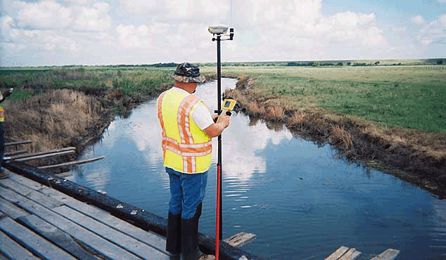
Each survey was performed using both conventional total station and GPS-RTK equipment and processed using Star*Net least-squares adjustment software. The Texas State Plane Coordinate System Central Zone is used as the datum for the survey. Metes and Bounds descriptions were prepared for each easement and include GPS coordinates that define the outer perimeter of the easement as well as the route of ingress. Global Positioning Systems (GPS) coordinates provided are represented in latitude and longitude (Degrees, Minutes and Seconds). Deliverables included digital data files generated in AutoCAD/LDD .Dwg format and Arc/INFO shapefile format. Original hardcopy and three copies of the easement plat as well as certified metes and bound legal descriptions signed by the licensed professional land are provided. All surveys were performed in accordance with NRCS standards.


