Electric Power

SAM Technology Symposium & Hospitality Event
A Discussion on Managed Geospatial Services ™
25 June, 2024 | 5:00 PM - 8:00 PM Hilton Anatole 2201 N Stemmons Fwy, Dallas, TX 75207 The Metropolitan Room
Comprehensive Geospatial and Inspection Services for Electric Power
SAM’s Managed Geospatial ServicesTM framework positively impacts the nature of many industries, but perhaps none more than the power industry and Power Line Inspection in particular.
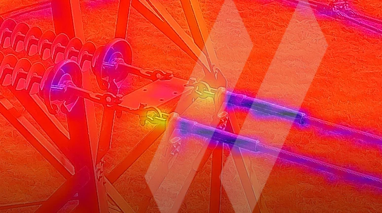
With a combined 70+ years of experience, our industry experts have devised a singular method in which advanced 8K video, corona, LiDAR, and infrared scanning technology can be combined to transform petabytes of complex spatial data into immediate deliverables—helping clients identify and solve infrastructure management issues in real time.
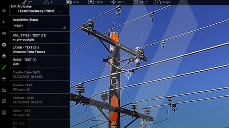
Too often, Power Line Inspection is conducted in a reactionary manner, in which problems are only realized and solved after causing damage or wasting time. This leads to inefficiencies, quality issues, and volatile pricing. Our approach is proactive, where anomalies are found, identified, and rated on a comprehensive four-tiered ranking system—all in real time. While most competitors are simply aviation companies, SAM is a holistic and multi-faceted Geospatial firm with extensive and wide-ranging industry experience.
With the ability to seamlessly shift between LiDAR, Corona, UHD, 8k, Infrared, and LiDAR data collection and image inspection methods, SAM’s professionals can adapt to the needs of each client with complete fluency. This allows for a curated, customized approach for each client. SAM’s deep technology expertise in Geomatics through our Managed Geospatial Services™ framework allows us to organize, map, and structure client data in a way no others can. Our secure, in-house analysis is conducted by leading experts, which means increased efficiency and faster results, with an ability to process structures and provide key insights faster than the closest competitors.
SAM is Trusted, Knowledgeable, and Innovative
SAM understands that when you start with Geospatial data you trust, you can move forward with confidence. We offer a full range of Geomatics, Utility Engineering, and Inspection solutions to support electric utilities and power developers. We possess trusted local market knowledge, offer innovative solutions, and have the ability to meet the most demanding schedules while operating on a national scale.
8K Video
LiDAR, RBG, & Thermal Imaging
Uas
Our People
SAM’s tenured team of licensed professionals, certified safety professionals, risk management professionals, data scientists, and technicians, bring exceptional experience and expertise to electric power market.
Why Sam?
SAM has built a reputation as a trusted, knowledgeable, and innovative partner.
SAM transforms petabytes of complex spatial data into intelligent insights in a holistic Managed Geospatial Services™ (MGS™) framework. MGS™ is the digital ecosystem that simplifies the complicated so our clients can achieve the impactful outcomes that drive their business forward.
As North America’s premiere MGS™ company, SAM provides practical, precise, and high-fidelity solutions designed to enhance decision-making, mitigate risks, achieve strategic objectives, and drive costs out of our client’s business. Our vision is to advance spatial data acquisition, improve analysis capabilities, and develop predictive analytics to redefine and transform how infrastructure assets are developed and managed throughout their lifecycles.
SAM IN ACTION
Routing Underground Electric Lines in Urban Areas
Discover how SAM’s Aerial Mapping, SUE, and other Geomatic Services help utility companies overcome the logistical challenges of undergrounding existing electric lines.
Using Applied Science to Determine Facility Ratings
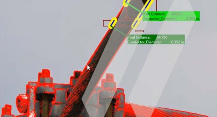
See how SAM is helping electric companies quickly and safely identify the most limiting component as part of the entire Bulk Electric System (BES) using mathematical formulas that leverage known conductor specifications.
Digital Twin: Digitizing Utility Infrastructure Inspections
Explore how SAM enabled remote substation inspections for an Investor Owned Utility (IOU) by creating interactive digital twins.
Improve The Efficiency Of Your Electrical Infrastructure Programs
Contact our team to find the right data-gathering solution for your critical infrastructure.


