
This project objective was to redevelop Perry’s inaccurate GIS for the City to be able to utilize the data moving forward for educated decision making when it comes to utility management.
The City of Perry, Iowa entered into GIS in 2006 with an engineering firm that provided GIS services. The City struggled to utilize the GPS data they received for managing their utilities and years after the initial program was created, Perry learned the data they were provided was not accurate and essentially useless in developing a comprehensive utility management program for their community. In addition to having inaccurate data, the City also had an aging utility staff nearing retirement.
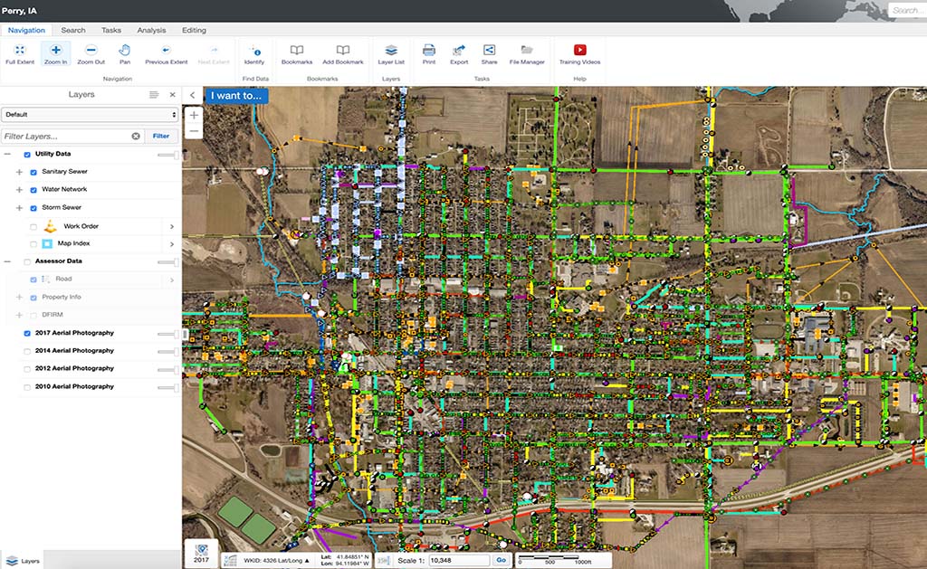
The City of Perry wanted to take an active role in the re-development of their GIS program and hired SAM (formerly Midland GIS Solutions) to re-locate all utility assets for water, sanitary sewer and storm water networks utilizing RTK GPS units. For the first time the City of Perry had a true depiction of their water, sewer and storm water networks.
The goal of the city was to have all of their utility data centrally stored in one virtual location, but exist in a multi-user environment. Our team developed an Integrity™ web GIS program for the City of Perry so that data could be accessed by multiple, authorized users. Maintenance of the City’s GIS program is streamlined with Integrity’s editing features.


