
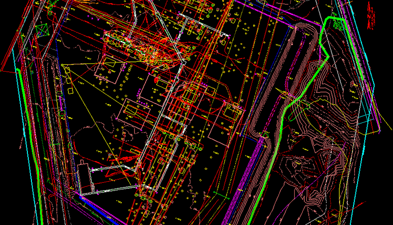
In April 2020, SAM completed work as a prime contractor for an electric utility client on a substation project in the southeast region of the U.S. SAM had performed Subsurface Utility Engineering (SUE) services at this substation previously, first in 2013 and then returning in 2014, providing both Quality Level A and B services. More recently, with the use of Terrestrial LiDAR and Ground Penetrating Radar technology as well as standard Survey and SUE equipment, SAM performed GNSS Site Control, Boundary, Topography, and SUE services on the 16+ acre substation. SUE services included Quality Level B-D–locating and verifying all underground utilities.
The project site is complex with high utility congestion consisting of both active and abandoned electrical facilities. The substation had seen many changes and additions to the infrastructure in the past five years since SAM had last worked in the area. The substation’s underground facilities almost doubled in size with more transformers and breakers as well as new troughs throughout the station. One of the many challenges for the SAM team was working through the troughs in the areas under the two main buses in the substation. While previous obstacles in 2014 included encountering many cut cables and empty conduits that were abandoned in place, the SAM team faced new challenges in 2020. Although the SAM team anticipated working in tight spaces while scanning and verifying all of the old facilities, one of their new challenges while working in the field was to isolate all of the newly installed facilities that were now co-mingled with the existing and previously abandoned facilities. In addition, there were several cell towers on site with limited access and heavy utility congestion; the active and abandoned electric made it more difficult than normal to trace where the communication lines were going.
With the use of advanced technology and software the SAM team provided our client with deliverables that included point cloud files, 2D and 3D AutoCAD basemap files with utilities, XML surface files, and a certified an-built drawing of the newly installed equipment and site improvements for record and future design.


