
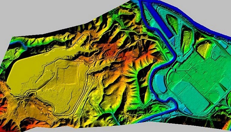
The Missouri Department of Conservation (MDC) identified the critical need for an Asset Management Program (AMP) for hundreds of facilities across the state of Missouri. As a basis for the data set, MDC wanted to utilize a high accuracy topographic model as a base map for each of their properties. Several MDC staff had a previous technical background from the Missouri Department of Transportation, and had utilized helicopter-acquired LiDAR on highway design projects. The scope of work and specifications for this project was derived from the engineering design level surveys that were performed for the Department of Transportation (DOT).
SAM (formerly as HALIS) teamed with the prime contractor Wilson & Company, to provide the following services to MDC: project management, ground control surveys, aerial LiDAR acquisition, LiDAR processing, digital ortho imagery, and quality control for the high accuracy mapping project comprised of 33 areas. These project sites included fish hatcheries, large wetland areas, lakes, parks, and recreational areas each posing unique challenges for acquisition due to terrain, timing of the flights with water releases, survey access concerns, and special foliage conditions for optimum information collected. The sites were located thought the state.
SAM mobilized both a helicopter and fixed-wing aircraft for the LiDAR acquisition, and a fixed winged aircraft for the aerial photography collection. The LiDAR was collected multiple sensors, depending on the level of accuracy and point density required site-by-site. The aerial imagery was flown to yield a two-inch pixel size for the color digital ortho imagery. Close coordination with the ground control survey crews was required to ensure any necessary targeting was in place prior to the flights, water levels were in acceptable ranges, and weather conditions were acceptable while minimizing the amount of ferry time for acquiring sites dispersed around the entire state. Ground crews surveyed photo identifiable control and checkpoints, tying the ground control network to the Missouri VRN NAVD88 and any recoverable benchmarks found in the area. The checkpoints were not used in the aerotriangulation computations, but served as an independent check of the photogrammetric solution. Two intervisible monuments were establish at each of the project sites.
Deliverables for the project included a survey report for each project site, 2″ digital ortho imagery, classified point cloud, planimetric feature file, and a Civil 3D surface model.


