
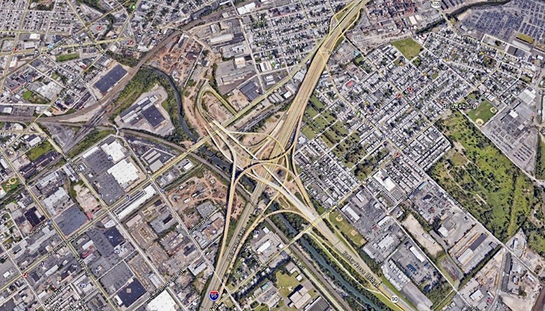
SAM provided Quality Level “B” utility designating mapping and Quality Level “A” test holes on an infrastructure initiative for Pennsylvania Department of Transportation (PennDOT) to improve and rebuild Interstate 95 in Philadelphia. The project’s main initiative is to widen the elevated highway that is the main north-south commuter route along the east side of Philadelphia. The scope of the project included rerouting adjacent streets to improve traffic flow and improving the storm and drainage system. SAM is a sub-consultant to CDM Smith for the I-95, Section BSR (Broad Street Ramps) portion of the overall project, which has presented several challenges. SAM worked in tandem with CDM Smith and the utility companies to provide accurate utility data on the existing utilities along I-95. In addition to the I-95 main lanes, underground utilities were mapped along existing and proposed off-ramps, streets adjacent to I-95, and areas below the elevated I-95 highway.
I-95 runs along the Delaware River and much of the storm drainage and sanitary sewer was installed more than 100 years ago and crosses below I-95. The exact locations of these large storm and sanitary structures needed to be documented by test holes due to large concrete encasements and the critical importance of those facilities to residents. Another challenge with this project was that the area is deemed historical. SAM worked in conjunction with archaeologists on-site and utilized historical maps found in archives. Several items were found using SAM’s vacuum excavation vehicles that otherwise may have been destroyed using alternative excavation equipment.
SAM excavated approximately 200 test holes and designated thousands of feet of water, wastewater, storm drainage, electric, cable, gas, and telecom utilities for this project. We completed our original scope and change orders. Tasks and deliverables included:
- Utility research and compilation of existing record information
- Field utility designating horizontal location utilizing electromagnetic, acoustic, and ground penetrating radar instrumentation
- Locating designated utilities using GPS-RTK related to project control
- Soft-dig exposure of utilities to determine/verify vertical position utilizing vacuum excavation trucks
- Signed and sealed engineering drawings depicting the results of the utility investigation
- CADD files in MicroStation v8 and supporting documentation delivered to client


