
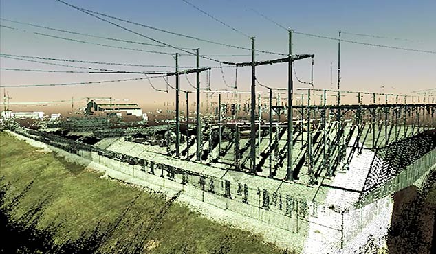
SAM performed ground-based terrestrial (HDS) and mobile LiDAR surveys for the Hill Country Substation in northern Bexar County, Texas. The client had an existing airborne LiDAR dataset for portions of the substation site, but the data contained voids in areas that were necessary to complete the design of improvements to the substation. Additionally, there was no as-built information for upgrades constructed since the original data had been collected. SAM was asked to provide a cost effective solution to collect the new data using terrestrial and mobile LiDAR, then integrate it with the existing airborne dataset.
HDS terrestrial LiDAR was used to scan the area inside the substation fence perimeters and mobile mapping LiDAR for four spans of new transmission lines west of the substation. The project was controlled using 10 control points within the specified limits of the survey area to accurately reference the scan data to the control network. Scanning was done with sufficient point density necessary to create an accurate as-built plan for the substation.
The LiDAR data was processed to extract features requested by the utility, including existing footings (whether occupied or unoccupied), fences, wires, attachment points and poles/structures within the specified limits, then each was assigned utility owner’s unique features codes. Deliverables included PLS-CADD files of the substation (conductors, bus work, structures and attachments), meteorological data and control data. The new data was then merged with the client’s original airborne dataset. The complete integration of all these data into one master dataset was a key value-added service that SAM was uniquely able to accomplish.


