
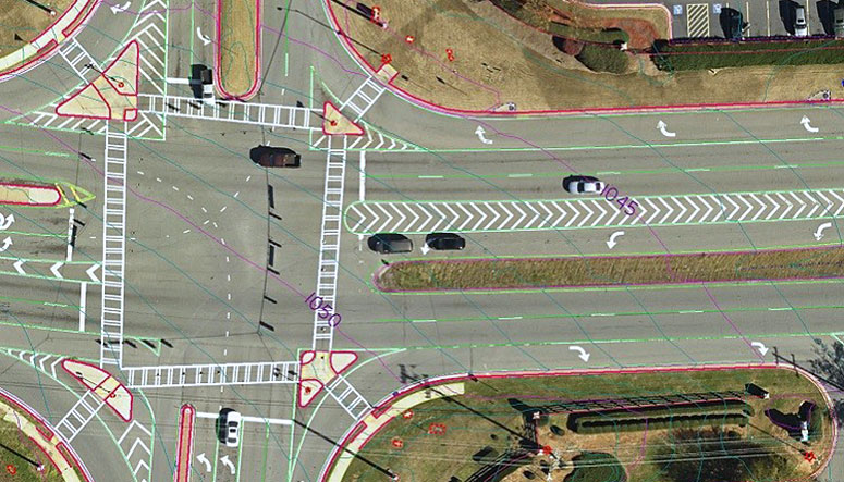
SAM (formerly as HALIS) completed aerial LiDAR and photogrammetry services to support design engineering of a 5-mile section of McGinnis Ferry Road near Alpharetta, Georgia. The project was designed to meet Georgia Department of Transportation (GDOT) accuracies, with a vertical accuracy of better than 0.1′ on paved surfaces.
Prior to acquisition of aerial data, SAM coordinated for the collection of ground survey data to support calibration and aerial triangulation. To meet the high accuracy required on the roadway, a subset of the required control was surveyed through the use of a closed level loop, with the remaining points collected utilizing standard GPS methodologies. Given the tight project deadlines, aerial data was acquired during leaf-on conditions. LiDAR data and aerial photography were acquired during the same flight and the acquisition of both datasets during a single flight reduced the overall cost of the project, and also ensured that ground conditions in each reflected the same conditions. Following flight, data was calibrated and adjusted to provided control to support final product deliverable accuracy.
Utilizing a combination of the LiDAR point cloud and imagery, SAM collected elevation data to support better than 0.1′ accuracy on pavement and 1′ contours across the remainder of the project. Planimetric features were collected to support 1″= 50′ accuracy, with color orthophotos generated to the same accuracy and delivered with a 3″ pixel resolution. Final deliverables were made to the client less than four weeks after receipt of control, and included MicroStation dgn files in GDOT CADD standards, SelectCad dtm file, and color orthophotography. Post-delivery ‘blind’ validation completed by the client certified the project as meeting the required accuracies when compared to data surveyed and withheld from the processing team.


