
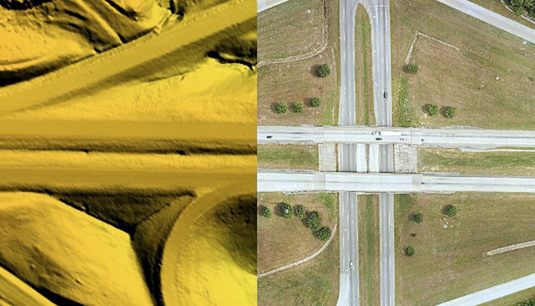
The I20 project in Carroll County, Georgia was completed to support resurfacing of an existing interstate roadway, and required vertical accuracy of better than 0.1′. The project alignment measured approximately 12.5 miles in length, and included both sides of the interstate extending at least 50′ from the edge of pavement, and medians between the interstate sides and between the on/off ramps.
Data acquisition included simultaneous imagery and LiDAR acquisition from a helicopter platform, with GPS data collected from both the aerial platform and a ground base station to facilitate the high accuracies required in the final product. Field surveys included the collection of nine control points and eight verification points, with locations selected by SAM (formerly as HALIS) and field surveys completed by Archer Western’s survey group. Control points were paneled to allow for identification in the aerial imagery.
Once data was calibrated to control (vertical accuracy better than 0.1′ at 95% confidence), breaklines and planimetric features were extracted to CADD format. Planimetrics includes transportation features (lane lines, guardrails, bridges), hydro features such as ditches, poles, and signage. Contours were generated at a 1′ interval and supplied with the DTM. Final delivery also included color 3″ orthophotography covering the full project route.


