
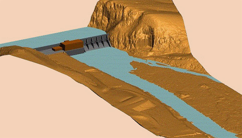
SAM (formerly as HALIS) was contracted to provide simultaneous LiDAR and Imagery acquisition of the Fort Patrick Henry Dam and downstream area. SAM contracted with a survey firm to provide field surveys to be utilized in the calibration of LiDAR data and triangulation of imagery.
Data Acquisition for this project included close coordination with dam personnel to ensure that acceptable downstream water levels were achieved. In order to fly with water as low as possible, SAM alerted dam personnel before flight window so that the dam could be closed. Once the dam was closed, data acquisition had to be completed within a four-hour window, starting 20 hours after closure. SAM completed one flight utilizing a helicopter platform for high density dam scan to be utilized in the construction of a 3D model, and a second fixed wing flight during low water conditions to be utilized in the generation of 1′ contour data and color orthophotography.
Project deliverables included DTM and 1′ contours in CADD format, 3D model of the dam in CADD format, orthophotography in TIFF format, and LIDAR Accuracy report in PDF format.


