
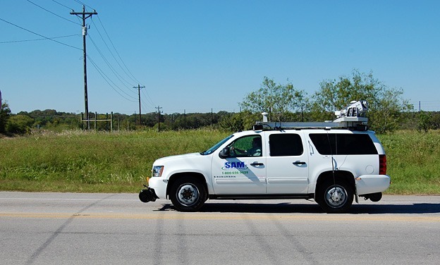
SAM used our mobile LiDAR technology to collect survey terrain data and produce full planimetric mapping for over 25 miles of a cross-country route in Mississippi. The design supported by the mapping included a combination of both aerial and buried sections. The client was a telecommunications engineering and construction firm involved in the design of a fiber system for rural communities. Mobile LiDAR was used for the project because using conventional survey methods would have been much more time-consuming, more expensive, and captured less information. Scanning technology allowed us to accelerate the project time line, capture more accurate and useful information about the project area, and provide detailed windshield view imagery of the project area.
The primary services provided by SAM included project planning, establishing survey control, data acquisition and calibration, data processing and feature extraction, QA/QC processes, and preparation of a MicroStation DGN file of the planimetric mapping and DTM/DEM files, LAS files, and geospatially referenced imagery for client delivery.


