
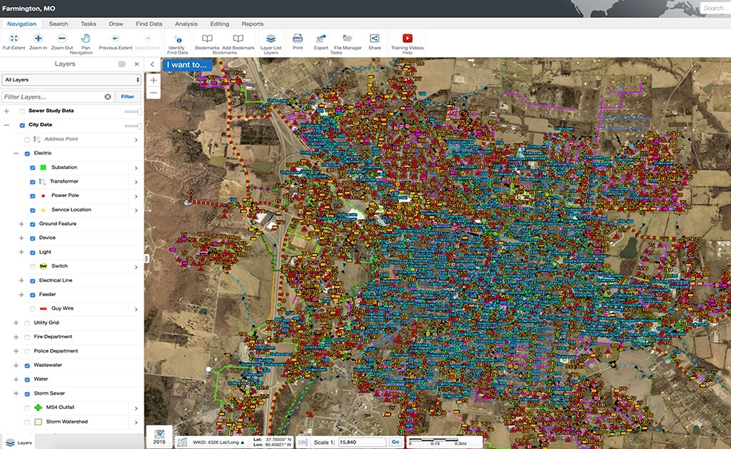
This project objective was to set up a centralized web-based GIS solution for the City on multiple utilities complete with asset management capabilities and data accuracy that will be model-ready for future engineering purposes.
Located just 70 miles southwest of St. Louis, MO, the City of Farmington, MO had maintained their utility data in CAD for years and decided to implement a more accurate utility mapping program, as well as a centralized web-based system to keep track of maintenance and operational activities. In 2012, Farmington selected SAM (formerly Midland GIS Solutions) based on qualifications to GPS locate and map their primary electric utility network. Our firm provided Farmington a complete and accurate GIS program of their electric utility network and integrated this data and aerial photography into a user-friendly web-based GIS program for the City to efficiently manage and maintain their GIS data.
In 2013, 2015 and 2018, the City selected our firm again to GPS locate, inspect and map their sanitary sewer, water storm water networks, respectively. On the storm water network, we utilized LiDAR as a reference to acquire storm drainage between GPS points.
We utilized decimeter level accuracy (+/- 4 in) to field locate all features associated with the electric distribution network for the City. Real-Time Kinematic (RTK) GPS methods were utilized to locate the sanitary sewer, storm water and water utility networks. This technology resulted in centimeter-level accuracy (+/- 2 cm) of GPS positions on utility features.
Today, the City has an accurately mapped system of their entire utility infrastructure, complete with attribute and inspection data that can be utilized in engineering modeling projects.


