
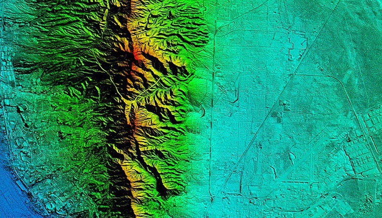
SAM (formerly as HALIS) was contracted to acquire, post process, and classify LiDAR for El Paso Water Utilities. The total area included 550 square miles and encompassed the challenging acquisition of the Franklin Mountains. We acquired the LiDAR data for QL2 accuracy scanning at a point density of 4 points per meter with multiple returns per pulse. Flight plans were submitted to EL Paso International Air Traffic control for coordinating and communications occurred during flight with U.S. Border Patrol. All GPS/IMU data was post processed to COR Stations and TerraPos (PPP) was used as a backup solution. SAM established strategic placement locations and contracted out the ground control and LiDAR verification points. This included the use of 55 total XYZ points, of which 20 were held back from data calibration for quality control testing of the LiDAR. Once the calibrated data sets met QL2 accuracy requirements, SAM begin the classification and bare earth of the LiDAR. SAM created a project tile scheme approved by the client and this was used for all deliverables. All data was presented and prepared for the use in an Esri environment and SAM delivered the following data sets:
Calibrated-unclassified point cloud
- All swaths, returns, and collected points, fully calibrated and adjusted to ground
- Fully compliant LAS v1.4 if full waveform data
- 16 bit Intensity values (native radiometric resolution)
- Vertical accuracy at 95-percent confidence level (9.25 cm RMSEz)
Classified Point Cloud
- All project swaths, returns, and collected points, fully calibrated, adjusted to ground, and classified, by tiles
- Tiled delivery, without overlap, using Project Tiling Scheme
- Vertical accuracy requirements for the point cloud at, 95-percent confidence level (9.25 cm RMSEz)
Esri Grid Bare-Earth Digital Elevation Model (DEM)
- Bare-earth DEM, generated through use of a triangulated irregular network (TIN) with cell size of 3 feet
- Tiled delivery, without overlap and no edge artifacts or mismatch
- Vertical accuracy of the bare-earth surface at a 95 percent Confidence Level (9.25 cm RMSEz)
Esri Grid Digital Surface Model (DSM)
- Generated from the LiDAR first returns
One Foot Esri Contours
- Esri Polyline Feature Class format, NAD83, Texas Central State Plane Coordinates


