
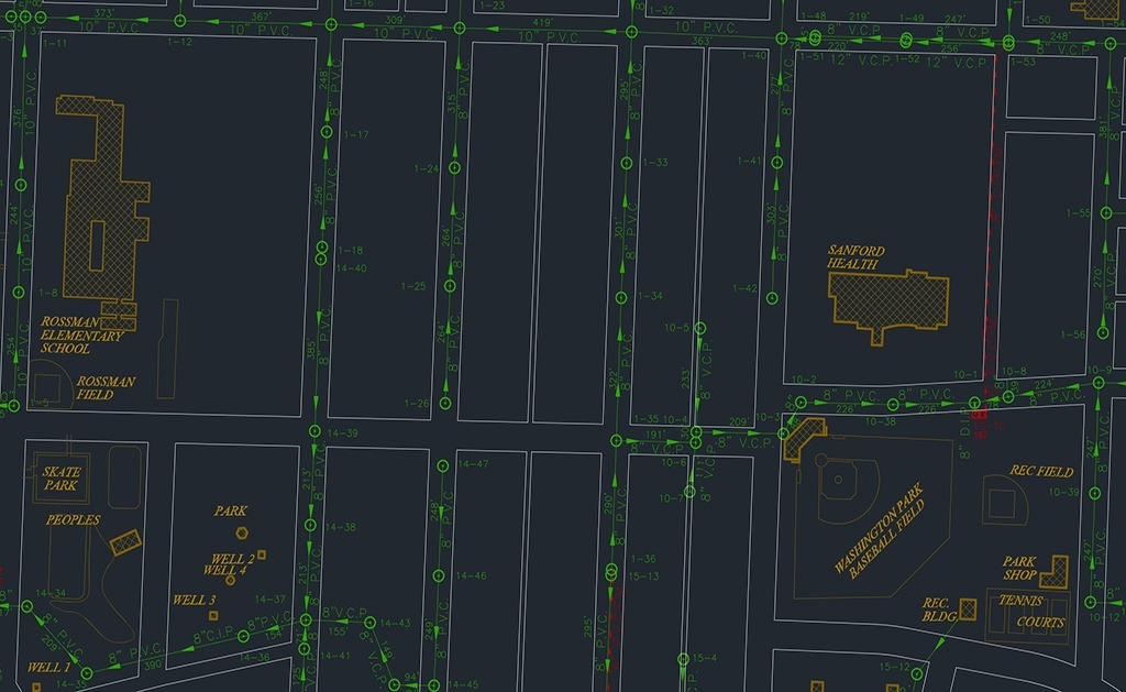
This project objective was to assist the City of Detroit Lakes, MN in migrating from their existing utility CAD program by accurately GPS locating their utility infrastructure and developing a comprehensive GIS program with web-based and mobile solutions.
In 2015, Detroit Lakes, MN selected SAM (formerly Midland GIS Solutions) to take over their CAD conversion project to GIS map their utilities. Over the course of several months, we were able to GPS locate and attribute all of the utility features associated with the sanitary sewer, water, and primary electric networks throughout the City. Our professional field staff also conducted thorough inspections of the City’s sanitary sewer network and incorporated this data into the GIS program.
An Integrity™ GIS website was created with mobile capabilities for the City to easily view, analyze and edit/update utility data within the GIS program. This project allowed the city to complete several years of their GIS plan in a matter of months. City officials in this thriving community now have the ability to analyze and query utility features and attributes, forecast short and long-term maintenance activities, and provide accurate data to engineers, while improving efficiencies in responding to sewer overflows, water main breaks, and other maintenance needs.


