
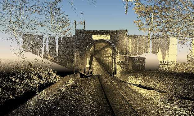
The BNSF railroad company had identified clearance concerns within a rail tunnel through the Cascade Mountains. The tunnel crosses the county line between Chelan County and King County, Washington. Detailed and comprehensive measurement data was needed in order to perform an engineering analysis to address the clearance concerns. Difficult access and the lack of GPS satellite signals in the tunnel made it very difficult to gather conventional survey data. Multiple attempts with conventional survey methods and clearance car scans had not produced acceptable results.
SAM was hired to perform mobile LiDAR scanning along a 7.8-mile section of rail tunnel as a means of obtaining more detailed measurement data. The mapping area included the tunnel area and 100′ beyond the portals at each end. A local surveyor installed control targets at 1,500′ spacing through the tunnel and SAM developed an approach to integrate those points with GPS to establish project control.
SAM used its hi-rail mobile LiDAR vehicle to scan the tunnel and capture survey data and digital images along the entire project area in a single day. The data was then registered to the specified State Plane coordinate system and used as a reference from which to extract 2D/3D CAD and terrain data. The CAD drawings and surface TIN developed from the LiDAR data were used by the engineer to analyze the tunnel and identify the specific areas of track/tunnel that needed modification to avoid the clearance issues.


