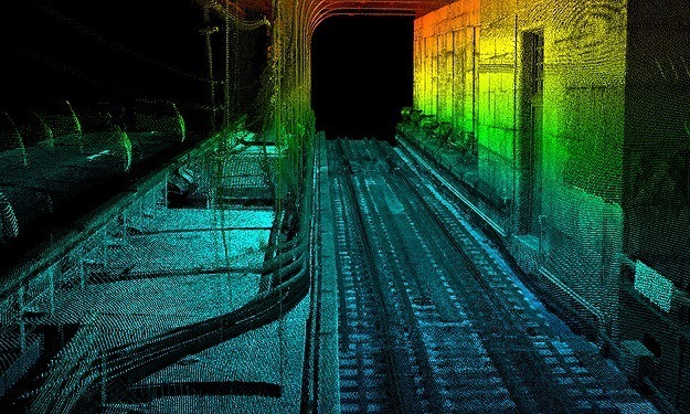
SAM collected three miles of commuter rail bridge with our mobile LiDAR mapping system to support a rehabilitation project on the Ben Franklin Bridge. Mobile LiDAR was the data collection technique of choice to address accessibility. The bridge is cantilevered off the side of the vehicular bridge, so conventional surveying and data capture methods would have been extremely difficult to obtain. Additionally, bridge shifting and sway issues are magnified over time. Using mobile LiDAR, we were able to safely and quickly capture all required data for this project. SAM created a smooth, best estimate trajectory, matched the trajectory with the scan data, fixed flight lines to survey grade mapping targets, stitched flight lines together and extracted the data. Data extracted included rails, railroad ties, I-beams, floor beams, timber straps and all impedance (electrical) bonds.


