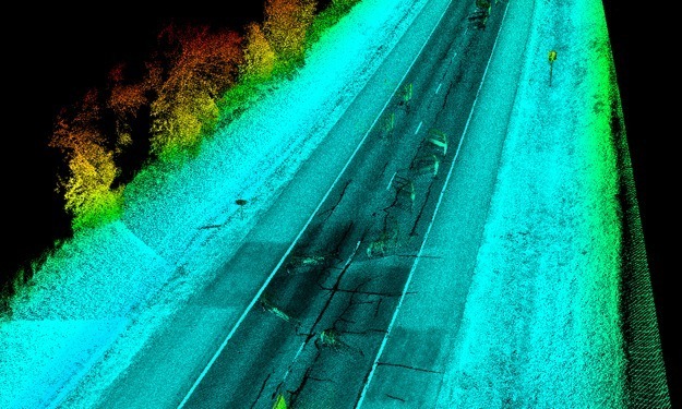
This project consisted of the design survey of a two lane US highway for the purpose of adding a passing lane as well as a shoulder widening along an eight mile stretch of road. SAM employed its mobile mapping unit for the purpose of collecting survey data on the pavement surface along the alignment, from edge of pavement to edge of pavement. The mobile mapping data for the project was collected in in the span of three hours. After point cloud calibration, SAM personnel extracted pavement break lines along the eight mile run in the span of four days. This data was then appended to conventional survey data collected in the field in order to generate a unified 2-D planimetric drawing and a 3-D DTM and TIN along the entire alignment from right-of-way to right-of-way.


