
SAM was recently selected to work with HDR, Inc. to provide SUE services and additional survey services which include right-of-way, property lines, topographic survey of obscured areas, and up to 6,000 LF of wetland boundaries along a selected route for the Low Country Rapid Transit (LCRT) in South Carolina. The project will use a static terrestrial scanner solution to survey under the I-26 overpass and bridges into downtown Charleston. The new terrestrial scan survey will enhance the level of information under the bridge, determining all clearances and ultimately improving the final design for the LCRT route.
Prior to this stage of the project, SAM was subcontracted by HDR, Inc. to provide professional surveying services for the LCRT. The LCRT is an approximately 26-mile proposed bus rapid transit corridor that will connect Charleston, North Charleston, and Summerville. The project is the result of a 15-month study to identify a fixed guideway transit alternative to improve transit service and enhance regional mobility along one of the most active bus routes in the area.
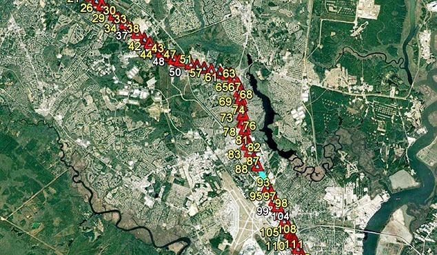
HDR, Inc. was contracted by the Berkeley-Charleston-Dorchester Council of Governments (BCDCOG), an agency of local governments that assists in planning for common needs for the three counties and municipalities, to lead the project. One of BCDCOG’s roles includes the administration and planning for the urban area public transportation provider. In addition to the local public transportation agencies, BCDCOG provides planning and project management for regional transit initiatives. BCDCOG managed the programming, planning, NEPA, and design services for LCRT. SAM’s Geospatial team used a hybrid solution on the LCRT project to provide topographic design mapping and surveying for the entire corridor. The hybrid solution includes aerial and terrestrial LiDAR coupled with aerial orthophotogrammetric imagery. SAM also provided terrestrial mobile scan LiDAR for high accuracy pavement mapping, and aerial LiDAR covering a corridor width of about 400′, going outside of the right-of-way and along the alternate routes. SAM performed the collection of LiDAR data using its dual sensor terrestrial mobile scan and its new 1560i aerial LiDAR sensor, paired with a RGB mapping camera. SAM’s photogrammetrists and Geospatial technicians performed LiDAR calibration and adjustment of both data sets, and conducted the mapping and extraction of all required planimetric and topographic features.
“This project was an opportunity for SAM to expand its services on the East coast,” said Luiz Cortes, Director of Geospatial Services, East for SAM. “By obtaining two sources of data sets on the project, and through the adoption of an innovative solution, we were able to provide our client with the necessary accuracy along the roadway in study. Simultaneously, the survey expanded into areas outside of the right-of-way—all combined in one final mapping.”
“We are honored to work as a consultant with HDR, Inc. and provide its team of engineers the information necessary for them to create and design the best plan and solution for their clients,” Cortes added.
All mapping on the original contract, which included 2-inch resolution digital orthophotos, was delivered to HDR, Inc. in accordance with the South Carolina Department of Transportation (SCDOT) standards by April 2019. HDR, Inc. used the mapping to evaluate the best route that will improve mobility, reduce crashes at intersections, and plan the location of bus stations in the proposed area.
In 2018 and 2019, SAM adopted a similar approach for two other projects in North Carolina and in Georgia, maintaining successful results similar to LCRT.


