
This project objective was to provide Macon Municipal Utilities with a comprehensive solution for multiple utilities to establish an asset management tool for one of the oldest infrastructures in the state of Missouri.
Macon Municipal Utilities (MMU) provides electric, water, wastewater, and natural gas utility services to the 5,500 residents living in the City of Macon, Missouri. MMU began its operations in 1890 and is one of the six (6) oldest public utilities west of the Mississippi River and third oldest in the State of Missouri. In 2011, MMU was seeking accurate locations of their infrastructure, along with inspections of their sanitary sewer network.
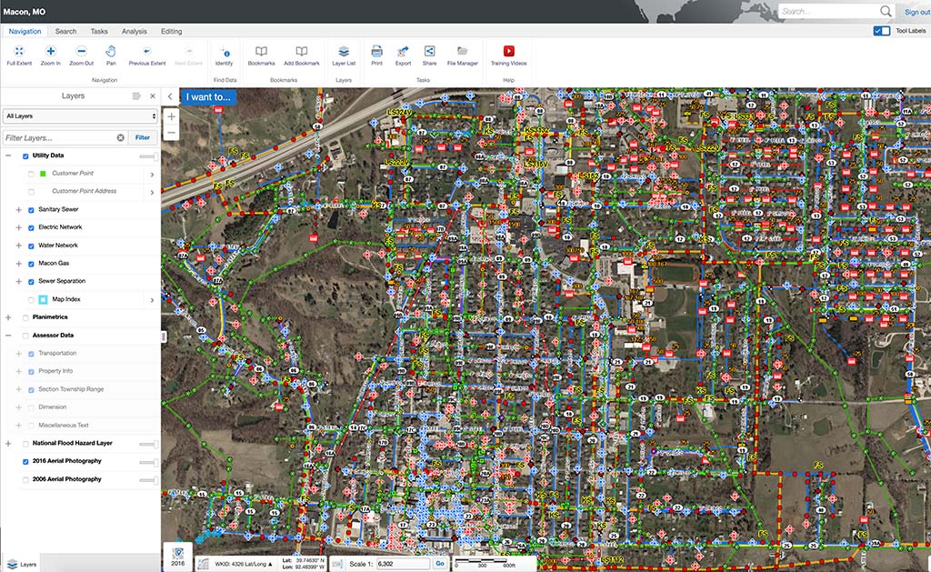
SAM (formerly Midland GIS Solutions) was selected by MMU based on qualifications originally in 2011 to GPS locate, inspect, and map their wastewater infrastructure utilizing RTK GPS technology. Our team also developed an Integrity™ GIS website for MMU to manage and maintain their GIS data. The website is utilized on a daily basis by Utility staff to analyze and query various data attributes and layers, and generate reports on gravity mains (flow direction, pipe size, pipe material, etc.), manhole conditions, and maintenance activities.
Following the implementation of the GIS program for the sanitary sewer system, MMU contracted with our firm to have their primary electric network GPS located and mapped. These layers were added to the existing GIS database and integrated into the GIS website. In 2014, we located the remaining utility networks, which included water and natural gas. In 2018, MMU again selected us to provide city street light inventory and mapping.
Today, MMU has a comprehensive utility GIS program and web-based GIS site with mobile capabilities to access data on their entire utility infrastructure. Utility personnel have the ability to access critical utility information in case of a natural disaster, water main break, power outage, or natural gas leak. Staff can also link documents or media, such as as-built maps, drawings, pictures, videos, etc. to features in the GIS program.


