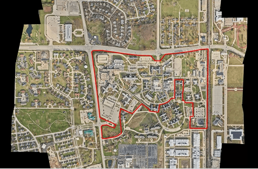
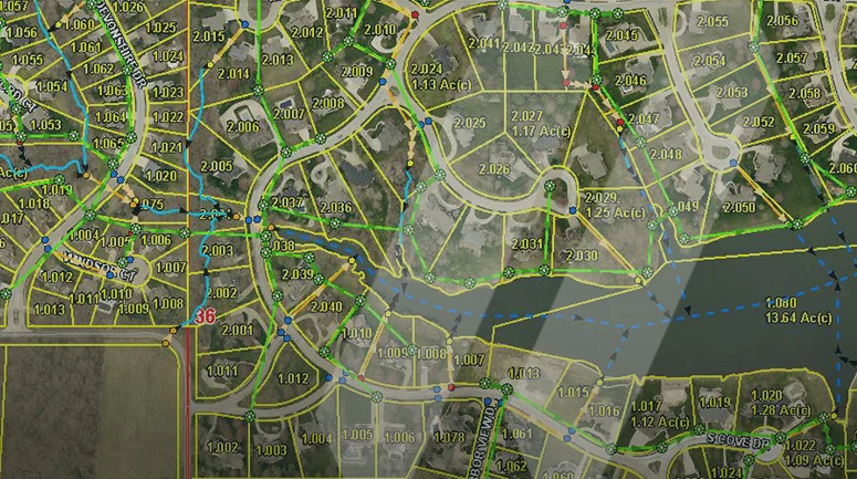
SAM delivers MGS™ in a holistic manner that involves collecting, curating, cleaning, securing, storing, enriching, and maintaining an organization’s Geospatial data so the owners or stakeholders can then leverage the information to make informed business decisions. MGS™ solutions are made up of several components, among which are data collection, data prep, data pipelines, and data warehouses that enable better governance, improved architecture, and increased security of your assets. GIS is a major pillar in achieving optimum performance through Managed Geospatial Services™ throughout the infrastructure lifecycle.
There are many reasons why MGS™ is important to businesses and governments today. First and foremost, world-class Geospatial data management helps drive business value or reduces a government’s operating costs. It provides the foundation for businesses and governments to manage their digital information as a trustworthy asset that they can rely on for sound, value-based decision-making and change detection. World-class GIS enables an organization to scale as the volume and variety of the Geospatial data grow, which is estimated to increase by 20% annually. It will improve collaboration across the stakeholder ecosystem because everyone is working off the same version of truth.
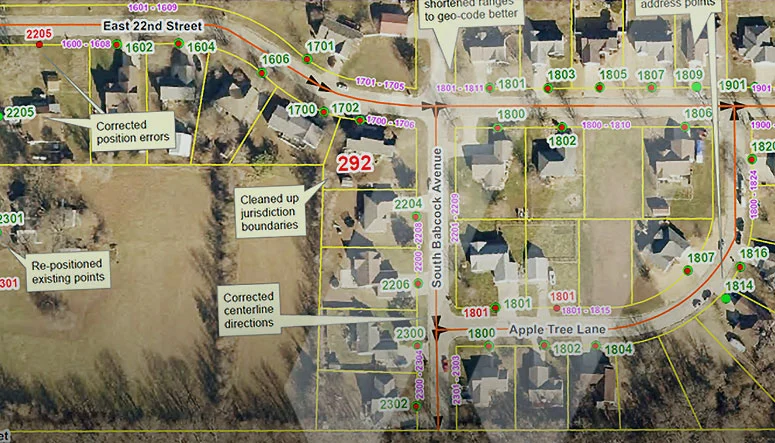
Managed Geospatial Services™ provides the structure and support to enable stakeholders to focus on higher-value work. Instead of spending their days scrubbing mundane data problems, they can focus on strategic objectives, and analyzing results to support informed decisions that align to strategic objectives. Finding the right solutions for your organization is key. SAM’s subject matter experts will review your current practices and develop an MGS™ improvement plan that establishes a blueprint for a better future.