BIM

SAM Technology Symposium & Hospitality Event
A Discussion on Managed Geospatial Services ™
25 June, 2024 | 5:00 PM - 8:00 PM Hilton Anatole 2201 N Stemmons Fwy, Dallas, TX 75207 The Metropolitan Room
let slug = location.pathname.split('/').slice(1); let trgt_btn = document.querySelector(".hov-orn") let base_url = document.querySelector(".hov-orn").getAttribute("href"); console.log(base_url) console.log(slug[0]) trgt_btn.setAttribute("href", `https://info.sam.biz/dallas-symposium?utm_source=${slug.join('-')}&utm_medium=SAM_web`)Managed Geospatial Services™ Documenting Indoor and Outdoor Assets
We measure the world from many perspectives™.
3D documentation using laser scanning is widely accepted by the Architectural, Engineering, and Construction (AEC) industry. Scan to Building Information Modeling (BIM) can transition to become the foundation to link business attributes to create intelligent asset management systems. BIM is recognized as the most trusted solution to prove as-built or as-building conditions. Quality 3D Geospatial data generates greater business value or can help governments reduce operational costs. Creating a holistically managed Geospatial ecosystem will propel your organization into the future.
SAM offers a full range of Managed Geospatial Services™ to support infrastructure improvements and managing assets. We are fueling progress through technological innovation. Reality Modeling, Scan-to-BIM, and Digital Twins are part of our innovative services. We have the trusted knowledge and the highest level of professional accreditations to support a full suite of Managed Geospatial Services™. SAM has experience throughout the asset management life cycle, so you will receive amplified value from our expert technical consulting.


KEY BIM SOLUTIONS
Scan-to BIM
Scan-to-BIM
Virtual Design Construction
Virtual Design Construction
3D Services
3D Services
Digital Twins
Digital Twins
Level Of Development (LOD) in your preferred digital format
The updated Level of Development (LOD) Specification released in 2013 was developed under an agreement with the American Institute of Architects (AIA) and uses the fundamental definitions developed by the AIA for its Building Information Modeling standards.
Who we serve
Commercial
Industrial
Government
Electric
Renewables
Water
3D REALITY CAPTURE
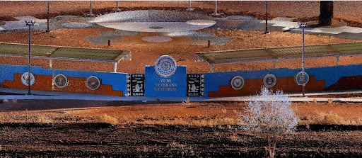
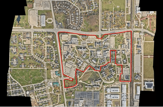
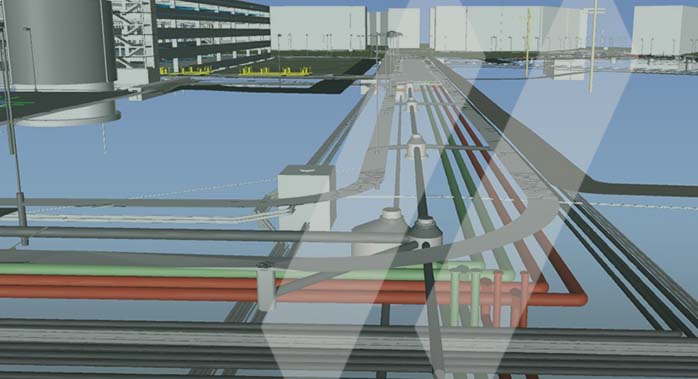
Reality capture of indoor and outdoor spaces encompasses high-fidelity digital scanning and 360-degree photography to create realistic models that are used in BIM and 3D software environments. The digital model can include underground utilities and assets above the ground but not clearly visible within a site. Stakeholders can use the geospatial data for design and construction considerations and then return the final designs back out into the real world for construction, fabrication, installation, and asset management for operational and maintenance functions.
There are many reasons why well-planned and well-organized geospatial data for assets are important. First and foremost, Managed Geospatial Services ™ helps drive business value. It provides the foundation for businesses to manage their assets and associated digital information as a trustworthy source that they can rely on for informed decisions. It helps ensure that internal or external data sources are of the highest quality and current. A holistic Managed Geospatial Service framework increases collaboration across an organization because everyone is working off the same version of the truth.
OUR PEOPLE
SAM’s team of licensed professionals bring trusted experience, knowledge, and innovation to every service engagement.
WHY SAM?
SAM has built a reputation as a trusted, knowledgeable, and innovative partner.
SAM transforms petabytes of complex spatial data into intelligent insights in a holistic Managed Geospatial Services™ (MGS™) framework. MGS™ is the digital ecosystem that simplifies the complicated so our clients can achieve the impactful outcomes that drive their business forward.
As North America’s premiere MGS™ company, SAM provides practical, precise, and high-fidelity solutions designed to enhance decision-making, mitigate risks, achieve strategic objectives, and drive costs out of our client’s business. Our vision is to advance spatial data acquisition, improve analysis capabilities, and develop predictive analytics to redefine and transform how infrastructure assets are developed and managed throughout their lifecycles.
Reality Models for BIM increases the Value of Assets.
Getting spatial data management right is a critical step further enabling improved business decisions.


