SAM’s Managed Geospatial ServicesTM framework positively impacts the nature of many industries, but perhaps none more than the power industry and Power Line Inspection in particular.
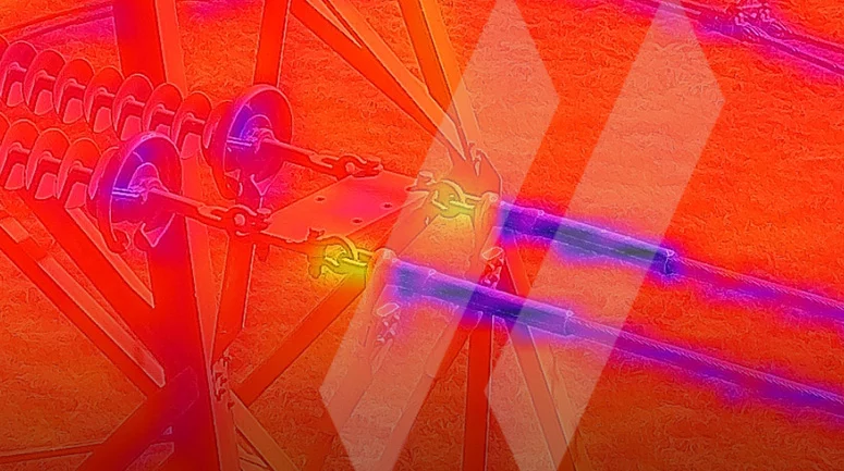
With a combined 70+ years of experience, our industry experts have devised a singular method in which advanced 8K video, corona, LiDAR, and infrared scanning technology can be combined to transform petabytes of complex spatial data into immediate deliverables—helping clients identify and solve infrastructure management issues in real time.
Too often, Power Line Inspection is conducted in a reactionary manner, in which problems are only realized and solved after causing damage or wasting time. This leads to inefficiencies, quality issues, and volatile pricing. Our approach is proactive, where anomalies are found, identified, and rated on a comprehensive four-tiered ranking system—all in real time. While most competitors are simply surveying companies, SAM is a holistic and multi-faceted Geospatial firm with extensive and wide-ranging industry experience.
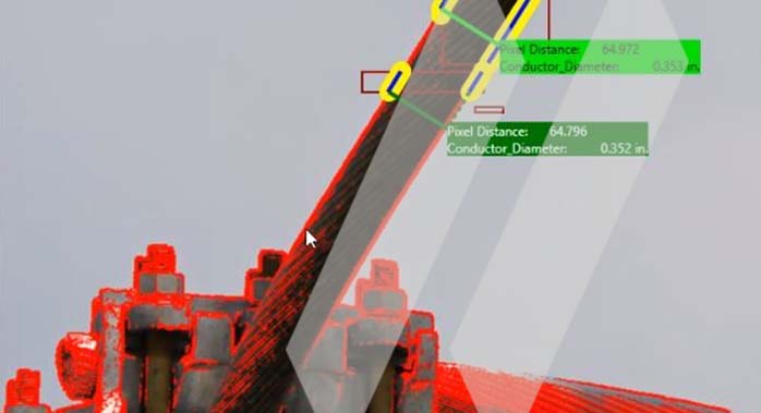
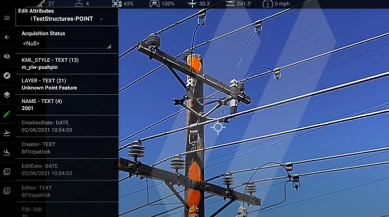
With the ability to seamlessly shift between LiDAR, Corona, UHD, 8k, Infrared, and LiDAR data collection and image inspection methods, SAM’s professionals can adapt to the needs of each client with complete fluency. This allows for a curated, customized approach for each client. SAM’s deep technology expertise in Geomatics through our Managed Geospatial Services™ framework allows us to organize, map, and structure client data in a way no others can. Our secure, in-house analysis is conducted by leading experts, which means increased efficiency and faster results, with an ability to process structures and provide key insights faster than the closest competitors.