
Advanced Technology
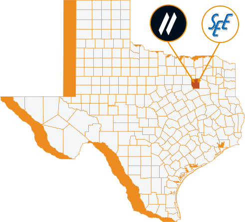
SAM Technology Symposium & Hospitality Event
A Discussion on Managed Geospatial Services ™
25 June, 2024 | 5:00 PM - 8:00 PM Hilton Anatole 2201 N Stemmons Fwy, Dallas, TX 75207 The Metropolitan Room
let slug = location.pathname.split('/').slice(1); let trgt_btn = document.querySelector(".hov-orn") let base_url = document.querySelector(".hov-orn").getAttribute("href"); console.log(base_url) console.log(slug[0]) trgt_btn.setAttribute("href", `https://info.sam.biz/dallas-symposium?utm_source=${slug.join('-')}&utm_medium=SAM_web`)The Cornerstone of Managed Geospatial Services™
Advanced Technology is embedded in SAM’s Managed Geospatial Services™. Modern scientific instruments, digital equipment, and software solutions provide the platforms to deliver inputs, insights, and outcomes to empower informed business decisions over the infrastructure lifecycle. SAM quickly mitigates risks to focus actions that align with your strategic objectives and positively impact the financial performance of your organization.
Leveraging technology, we capture geospatial data faster and with meticulous precision and accuracy, translating the results into actionable intelligence that supports informed business decisions. It’s our unwavering commitment to innovate today that transforms our vision of tomorrow.
Proprietary Solutions
SAM INSPECT™
Our inspection management software incorporates AI/ML to streamline Geospatial workflows, thus improving the inspection, classification, and inventory of structures and components. SAM Inspect™ enhances condition-based operation and maintenance decisions with a convenient desktop examination of assets such as transmission structure integrity, condition of individual components, and vegetation encroachment threats to prioritize maintenance plans.
SAM Field™
SAM Field™ offers a cloud-based, paperless approach to field data collection, providing our clients with a workflow that maximizes speed, efficiency, and accessibility. Organize your infrastructure inspection and documentation processes with a single, easy-to-use application that provides real-time insights.
SAM Milestone™
SAM Milestone™ is our software solution focused on efficiently meeting client needs by identifying Key Performance Indicators to prioritize major contract milestones, align tracking workflows, and provide business insights into schedule, budget, and quality providing you with full visibility. Anticipate potential schedule delays to complete your program on-budget and on-time.
SAM Capture™
SAM Capture™ is a tablet-based platform supporting the geospatial data lifecycle from field collection to office analysis with functionality to organize and transfer field data, automatically generate reports for real-time progress monitoring with client standards and provide asset management for easy equipment tracking and financial reporting. Turn LiDAR, imagery and associated intelligent attributes into actionable business information.
SAM Vantage™
Our utility locating solution provides rich visual context of above and below ground assets by delivering real-time 3D field location, documentation, mapping, and improved team collaboration enabling utilities to make better decisions for managing assets, from engineering due diligence, through design, development, and operations.
SAM Integrity™
Our software is a cloud managed geospatial system with an intuitive interface that simplifies the operational tracking and asset management for any level of GIS for Local Government, Independent Operating Utilities, Transportation and Renewable Energy assets. Geospatial data is accessible across mobile and desktop devices that allows users to efficiently manage, analyze, and enhance GIS data. The secure cloud platform delivers robust color photography and thermal imagery tools, visualizations and configurable workflows and reports across the client’s enterprise and can provide access to geospatial data to the public and other stakeholders.
Key Technologies
Machine Learning Models
With advanced Machine Learning models backed by human intelligence, SAM rapidly classifies and translates raw geospatial data into actionable insights, accelerating schedules, and improving outcomes. Our library of ML models is rapidly growing and being refined as a result of the millions of images we acquire annually.
Augmented Reality
SAM leverages Augmented Reality technology for the interactive visualization, inspection, and analysis of spaces and assets without being onsite – beneficial for digital twin creation, and reality models for design evaluations, virtual asset management and condition assessment. The technology is revolutionizing Engineering Inspection and is heavily dependent on 3D design models that must be calibrated to actual site conditions.
Innovative
Information rich geospatial data is foundational to support a range of planning and engineering applications. SAM’s innovative collection methods deliver actionable intelligence through a holistic Managed Geospatial Services™ framework. We deliver insights to drive successful client outcomes in complex urban environments and the most challenging terrains. SAM acquires premium LiDAR and Imagery that achieve survey grade accuracies. Intelligent attributes provide the insights to analyze the visible and invisible spectrums to support informed business decisions. Digital 3D reality maps are optimized for client workflows. SAM has developed AI and ML models to classify, extract features and inspect infrastructure that our data scientists further refine.
HOW WE DO IT
We transform petabytes of complex spatial data into intelligent insights in a holistic Managed Geospatial Services™ framework. SAM Researches, Locates, Inspects, and Digitizes Our Clients’ Infrastructure Assets and Surrounding Environments throughout their full lifecycle. We use our deep knowledge of infrastructure, land use and natural resources to help you make informed decisions on a wide range of geospatial and inspection applications. We combine high-accuracy geospatial data from multiple platforms and sensors to meet your evolving needs, including increasing data volumes, performance optimization and enhanced data security. SAM turns individual transactional data into a valuable enterprise asset that gives you and your stakeholders a single source of truth. SAM is fueling innovation and offers the broadest portfolio in the industry supported by the most advanced technology, including high-density terrestrial, mobile, and airborne LiDAR and image solutions, 3D scanners, and leading-edge instruments that collect enriched geospatial data for BIM, Digital Twins, 3D Reality Models and GIS. Invite SAM’s professionals to review your current practices and develop an MGS™ improvement plan that establishes a blueprint for a better future.
Learn more about Managed Geospatial Services™
Partner with SAM to gather, process, and analyze the Geospatial data you need to advance your program.