
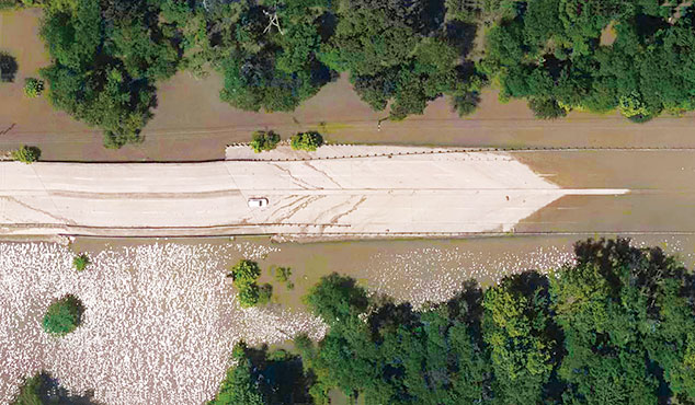
In 2016 following Texas’ most significant flood event in the Houston area since Tropical Storm Allison in 2001, there was an immediate need for damage reconnaissance in the aftermath. Pool levels in the Addicks and Barker reservoirs had reached their historic peak due to these stormwater flood events, with dam control monitored by the U.S. Army Corps of Engineers.
SAM was hired by the Harris County Flood Control District to provide aerial mapping of the region. We began the first phase by acquiring digital aerial imagery from a fixed-wing platform and processed the data to produce 15 cm (0.5 foot) pixel resolution orthographic photos for the Addicks and Barker Reservoirs. Once that data was acquired and delivered, SAM conducted the second phase of the project by flying six of the most affected watersheds in Harris County, totaling more than 1,030 square miles. The imagery was collected in two days at 7.5 cm (0.25 foot) pixel resolution. Digital orthographic photos were delivered by watershed in order of significance, per the client’s request.
Final delivery of the project was one week ahead of schedule. The project demonstrates the importance of strong client relationships and SAM’s ability to respond rapidly to meet client needs.


